Trip Info
-
Tea House & Tented Camp
-
Included (Guide & Staff)
-
Trekking & Climbing Permits Included
-
6,121 meters
-
Kathmandu
-
Spring & Autumn
-
Kathmandu
-
Professional Climbing Guide
-
Airport Pickup & Drop Included
-
30 Days Before Start
Chekigo Peak Climbing-26 Days
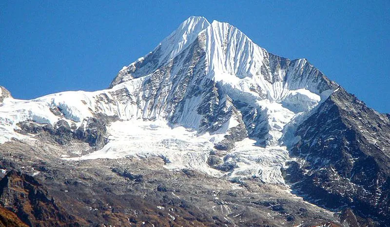
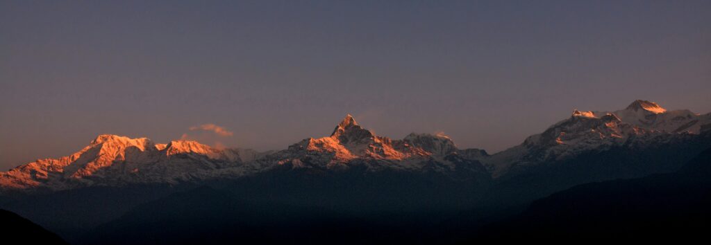
Chekigo Peak, standing at 6,121 meters in the Rolwaling Himalaya of Nepal, is one of those climbs that genuinely rewards patience. It sits far from the crowded trekking corridors, in a valley that still feels like it belongs to the mountains rather than to tourism. For climbers who want a technically meaningful objective without the circus of Everest Base Camp, this is a strong contender.
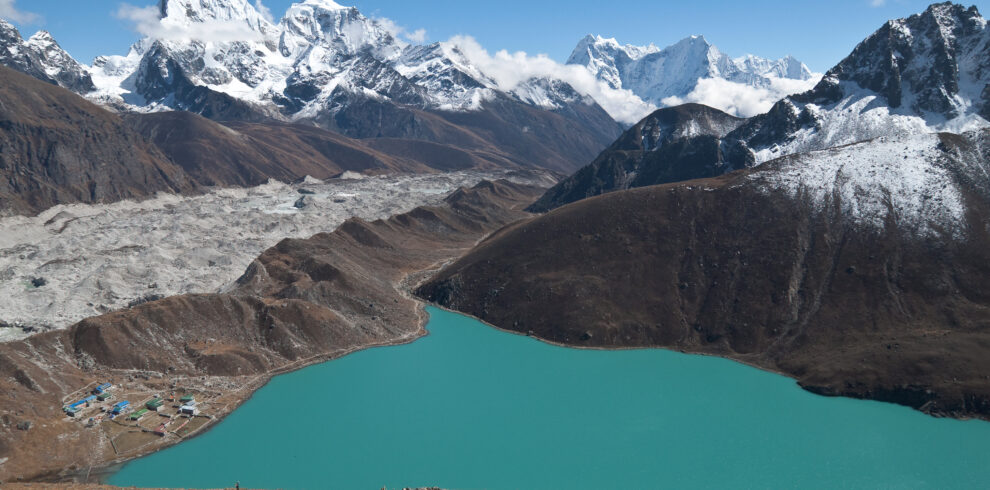
The route passes through some of the most quietly dramatic landscapes in eastern Nepal. You walk through the river gorges below Jagat, climb into the high village of Simigaon, cross the cold pass at Daldung La, and eventually reach Beding, a stone-built Sherpa settlement that sits like a forgotten outpost beneath glaciated walls. From Beding, the trail pushes upward into the raw terrain around Chekigo Base Camp, where the real work begins.
Nepal Holiday Treks designed this 26-day itinerary to give climbers the time they actually need, not the minimum days that sound appealing in a brochure. The acclimatization structure is deliberate, the climbing window is generous, and the return journey retraces the same valleys with a different kind of satisfaction. If you have been looking for a Himalayan climb that tests your technical skills and takes you somewhere genuinely off the standard path, Chekigo delivers exactly that.
Trip Highlights
- Rolwaling Himalaya
- Highest trekking peak in Nepal
- Views of high village of Simigaon
- Remote and less crowded trekking route
- Gradual acclimatization for safety
- Climbing training included
- Glacier walking experience
- Cultural experience in traditional Himalayan villages
Itinerary
Your expedition begins the moment you land at Tribhuvan International Airport and step into the organized chaos of Kathmandu. Representatives from Nepal Holiday Treks will be waiting to transfer you to your hotel in Thamel, the traveler’s hub of the city where narrow lanes are stacked with tea shops, gear stores, and thangka paintings hanging in doorways. The afternoon is yours to settle in, sort your gear, and let your body adjust to the first change of time zone and air. If you walk out in the evening, Thamel is best explored on foot, where you can pick up any last-minute supplies or simply sit at a rooftop restaurant and watch the city move below you. The briefing for the full expedition typically happens this evening, so you get a clear picture of what lies ahead before you even leave the valley.
The morning is spent finalizing the expedition paperwork, collecting permits, and double-checking that every piece of climbing and trekking gear is accounted for. This is not a day to rush through. Permit processing takes time, and any equipment gaps are far easier to fill in Kathmandu than anywhere else on the route. Once logistics are wrapped up, the afternoon opens into one of the more unexpectedly rewarding cultural days on the entire trip. Patan’s Durbar Square holds a cluster of Newari temples built in a style that looks like it was carved rather than constructed, with tiered rooftops and stone deities sitting at courtyard corners. Bhaktapur, a short drive away, feels like a city that simply refused to modernize, with its pottery squares, woodcarved windows, and the famous Nyatapola Temple rising in five dramatic tiers. Walking these squares gives you something real to carry into the weeks ahead.
The drive east from Kathmandu follows the Araniko Highway before turning off into progressively narrower roads that climb and twist through terraced hillsides and small roadside settlements. The journey itself is part of the transition, pulling you steadily away from the noise of the capital and into the slower rhythms of rural Nepal. Villages appear at intervals along the road, each one with its own small market or tea stop, and the hills grow greener and steeper the further you travel. By the time you reach Shigati, the air is noticeably different, cooler and quieter, and the outline of the Rolwaling Valley starts to take shape in the distance. This is where the walking begins tomorrow, and there is something useful about arriving in daylight so you can see the lay of the land before you put on your boots.
The trail out of Shigati drops you quickly into the rhythm of river-valley trekking, following the Tama Koshi River as it carves through forested gorges with steep walls on either side. The path is well-worn but not crowded, and the sound of fast water stays with you for much of the day. You pass through small settlements where children play outside stone-walled houses and locals carry loads that would stop most visitors in their tracks. The vegetation here is dense and subtropical in character, with banana plants giving way to rhododendrons as you gain ground. Jagat itself is a modest village sitting above the river, compact and functional, with guesthouses that offer exactly what you need after a long first day of walking. Arriving here signals that you have properly left the road behind.
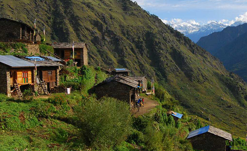
Today the trail climbs more consistently, and you feel the difference in your legs by mid-morning. The forest thickens above Jagat and then opens again onto terraced fields where the valley widens briefly before narrowing back into steep side walls. Prayer flags begin to appear more frequently, tied to outcrops and strung across trail junctions, which signals that you are entering the cultural territory of the highland Sherpa communities. Simigaon is a Sherpa village with stone homes arranged along the hillside in a way that looks almost deliberate, each one angled to face the valley below. A small gompa sits at the upper edge of the village, and if you arrive with enough afternoon light left, it is worth a quiet look inside. From here, the mountains you came to climb start to feel less abstract.
This is one of the harder days on the approach, and the trail makes no attempt to hide that. The climb to Daldung La is relentless in stretches, gaining significant elevation through alpine meadows, rocky moraine, and sections where the path narrows against exposed ridgelines. The views open dramatically as you gain height, with the Rolwaling peaks beginning to show themselves clearly across the upper valley. Daldung La itself is a cold, windswept place where prayer flags whip constantly and cairns mark the crossing point. Standing there, looking back down the valley you just climbed and forward into the descending landscape ahead, is one of those unscripted expedition moments that stays with you longer than any summit photo. The descent from the pass is steep and demands concentration.
The path down from Daldung La into the Rolwaling Valley proper is a gradual unfolding of one of Nepal’s most isolated high-valley landscapes. The trail descends through open terrain where yaks graze at meadow edges and the river below grows audible long before it becomes visible. Beding appears in stages: first a suggestion of stone walls, then rooftops, then the full shape of the village sitting solidly in the valley floor with glaciated peaks framing it on three sides. This is a real community, not a seasonal outpost. Villagers keep kitchen gardens, children attend a small school, and the local gompa is an active place of practice rather than a display piece. Settling into Beding for the first time, you understand why mountaineers have been using it as a base of operations for decades.
A rest day in Beding is not a passive experience. The standard acclimatization approach involves a short hike above the village to gain some height before returning to sleep lower, and the terrain above Beding offers excellent options for this. You can walk up toward the moraines of the Ripimo Shar Glacier, where the landscape becomes a textbook example of glacial geology: polished boulders, meltwater streams cutting through loose debris, and the slow groan of ice that you feel more than hear. Back in the village, the afternoon can be spent talking with local families, visiting the gompa, or simply watching the light move across the peaks as the temperature drops. Your body is adjusting to the elevation, and letting it do that without pressure is genuinely the right call here.
The trail from Beding to Base Camp moves through a landscape that transitions from inhabited valley to raw glacial terrain within a few hours of walking. The stone walls and fields of the village give way to moraine ridges, boulder fields, and eventually the open expanse of the glacier approach where the ground becomes unstable underfoot and route-finding requires attention. Chekigo Base Camp is not a luxurious place. It is a flat area of glacial moraine where tents are pitched among rocks, and the view from your tent entrance is a wall of ice and snow that fills the horizon. But the drama of the setting is part of the point. By the time you arrive, make camp, and eat your first meal with Chekigo visible above, the scale of what you came to do becomes concrete in a way that no amount of planning could have conveyed.
The ten-day climbing window is structured around acclimatization rotations, load carries, and weather windows rather than a single linear push to the summit. The early days involve establishing Camp I on the lower glacier, fixing ropes on the technical sections above, and rotating between the camps to let your body absorb the altitude progressively. The terrain on Chekigo requires careful crampon and ice axe technique, particularly on the steeper pitches above Camp I where the angle kicks up sharply. Summit day, when conditions align, is a predawn start from high camp with headlamps cutting through the dark and the temperature well below freezing. The final ridge to the summit at 6,121 meters offers a view across the Rolwaling range that stretches from Gauri Shankar to Menlungtse and, on a clear day, a line of peaks running all the way to the Khumbu. The descent back to Base Camp requires the same concentration as the ascent. The climbing window also builds in contingency days for poor weather, which is a realistic feature of any Himalayan expedition rather than an optional luxury.
Coming down from Base Camp after a successful summit period is its own kind of experience. The body is tired in a deep way that sleep and food will eventually address, but the mind is unusually clear and quiet. The trail back to Beding reverses the same terrain you covered on Day 9, but it reads differently now. The moraine that felt aggressive on the way up feels navigable on the way down, and the first sight of Beding’s rooftops in the valley below prompts a genuine sense of relief. The village welcomes you back in its undemonstrative way, with the same smoke rising from the same chimneys and the same yaks at the field edges. A warm meal and a proper night in a guesthouse at this point is genuinely restorative.
The return crossing of Daldung La has a different character than the outbound crossing. You know the pass now, which makes the climb less uncertain but no less physical. The trail climbs steadily from Beding through the same open terrain and exposed ridgelines, and the cold at the top of the pass hits with the same force regardless of which direction you are traveling. What changes is the perspective: looking back into the Rolwaling Valley from the pass, you can see the upper ridges where you spent the past two weeks, and the scale of the terrain you moved through becomes visible all at once. The descent on the far side brings you back into the warmer air and denser forest of the middle elevations.
The trail from the pass back down to Simigaon follows the same line you traced on the way up, but gravity is now working with you rather than against you. The descent through the alpine zone and back into the terraced hillsides around Simigaon passes quickly when you are moving downhill with lighter packs and rested legs. The village receives you with the same quiet dignity it showed on the approach, and the gompa at its upper edge looks just as it did before. There is something satisfying about retracing a route you now know well, recognizing the rock formations and trail junctions that were just features on a map two weeks ago. Simigaon, small as it is, feels like a real landmark at this point.
The downward trend continues today as the trail follows the valley back toward the river gorge below Jagat. The vegetation thickens noticeably as you descend, and the warmth of the lower elevation is a genuine physical pleasure after weeks above the treeline. The trail passes through the same small settlements you walked through on Day 4, and the familiar faces at tea stops along the way make the return feel less like retreat and more like closing a loop. Jagat by now feels almost comfortable, a known quantity at a known point in the journey, with a guesthouse meal waiting at the end of a shorter and more straightforward day than most of the preceding ones.
The final day of actual trekking covers the same river-valley terrain that opened the walking portion of the trip, and the contrast with the high mountain environment you just left is striking. The Tama Koshi runs fast and loud below, the forest is dense and green, and the subtropical warmth that felt unremarkable on Day 4 now feels almost tropical after weeks at altitude. By the time Shigati comes into view, you have covered the full arc of the approach and return, and the road that was the starting point of the walk is waiting again. It is worth taking a moment at the trailhead before climbing into the vehicle, just to register that the walk is finished.
The return drive retraces the Araniko Highway back toward the valley, and Kathmandu materializes gradually through the window as the road descends and traffic increases. The city that felt like a brief stop on the way out now has a different gravity, and the comforts it offers, hot showers, restaurant food, reliable electricity, are not taken for granted. The evening in Kathmandu is a natural point for the expedition team to gather, share a meal, and close the journey in a way that feels appropriate rather than abrupt. Nepal Holiday Treks typically organizes a farewell dinner on this night, which gives everyone a chance to decompress together before the formalities of departure the following morning.
The final morning is straightforward. Checkout, transfer to Tribhuvan International Airport, and the beginning of the journey home. If your flight departs in the afternoon, there is usually time for a last walk through Thamel or a final cup of Nepali tea at the hotel. What you carry out of Nepal after a 26-day Chekigo expedition is harder to inventory than your pack. It is a specific combination of physical accomplishment, geographic memory, and the quiet confidence that comes from having spent real time in a serious mountain environment.
Includes/Excludes
Cost Includes
- Airport pickup & drop
- Professional climbing guide
- climbing permit
- Trekking permits
- Accommodation during the trek
- Tented camp at Base Camp
- All meals during the trek
- Climbing training
- Safety equipment
- First aid support
- Support staff
Cost Excludes
- International airfare
- Personal climbing gear
- Travel insurance
- Personal expenses
- Tips for guide & porter
- Extra accommodation
- Emergency rescue
FAQs
Not quite. You need prior experience with crampons, ice axes, and technical terrain. Chekigo involves glacier crossings and fixed ropes on steep snow near the summit. It rewards solid alpine experience, not ambition alone.
Post-monsoon (late September to November) offers the clearest skies and most stable mornings. Pre-monsoon (April to early June) works too, though expect clouds by early afternoon. Both seasons are viable.
No. Your expedition team handles all paperwork in Kathmandu on the preparation day, including the NMA climbing permit and Gaurishankar Conservation Area entry.
Very fit. The Rolwaling approach is long and uneven. Train with a loaded pack on uphill terrain for at least two to three months beforehand. One shorter high-altitude trip in the lead-up helps significantly.
No. A licensed guide is required inside the conservation area. Beyond the regulation, the valley is remote enough that local knowledge is genuinely necessary for navigation and safety.