
Trip Info
- Tea House & Tented Camp
- Included (Guide & Staff)
- Trekking & Climbing Permits Included
- 6,476 meters
- Kathmandu
- Spring & Autumn
- Kathmandu
- Professional Climbing Guide
- Airport Pickup & Drop Included
- 30 Days Before Start
Kusum Kanguru Peak Climbing 17 days
Kusum Kanguru is one of the most technically demanding trekking peaks in Nepal, rising sharply above the Solu-Khumbu region at 6,367 meters. Unlike the well-worn trails leading to Everest Base Camp, the route to Kusum Kanguru stays raw and largely untouched, threading through dense rhododendron forests, remote Sherpa villages, and high alpine terrain that rewards every upward step with increasingly dramatic views of Thamserku, Kangtega, and the Ama Dablam massif.
The 17-day journey begins in Kathmandu, flies into Lukla, and follows a challenging approach through the Hinku Valley before the technical summit push. This is not a standard trekking peak. The climb involves steep rock and mixed terrain, fixed ropes on the upper sections, and a summit day that demands focus, physical conditioning, and proper acclimatization.
Nepal Holiday Treks designed this itinerary with built-in rest and acclimatisation days, so climbers arrive at the base camp rested, not depleted. For those who want a genuine Himalayan climbing experience away from the crowds, Kusum Kanguru offers exactly that: technical challenge, wild beauty, and the deep quiet of the Khumbu backcountry.
Trip Highlights
- Solu-Khumbu region at 6,367
- Highest trekking peak in Nepal
- Views of Kusum Kanguru and Lukla
- Remote and less crowded trekking route
- Gradual acclimatization for safety
- Climbing training included
- Glacier walking experience
- Cultural experience in traditional Himalayan villages
Itinerary
You land at Tribhuvan International Airport and step into the organized chaos of Kathmandu. The city hits you immediately with its mix of temple bells, motorbike horns, and the smell of incense drifting from street shrines. Your guide from Nepal Holiday Treks meets you at the airport and transfers you to your hotel in Thamel. The evening is yours to explore the narrow lanes of Thamel, grab a meal at one of the rooftop restaurants overlooking the street, and do a final gear check. A pre-departure briefing covers the route, safety protocol, and what to expect in the days ahead.
The early morning flight from Tenzing-Hillary Airport in Ramechhap (or domestic terminal) drops you into Lukla in under 30 minutes. The airstrip clings to a hillside at a steep angle. Landing here is an experience in itself. From Lukla, the trail drops down into the Dudhkosi valley, crossing suspension bridges strung with prayer flags, their colors fading from seasons of wind. Yak caravans share the path with local porters and the occasional school group. Phakding sits beside the river, a compact village of stone lodges with small gardens and resident dogs that barely acknowledge passing trekkers.
Today is the climb that earns you Namche. The trail crosses several high suspension bridges over the roaring Bhote Koshi before the long uphill push through pine and rhododendron forest. The Hillary Bridge section offers the first proper view of Everest on a clear day, just a white triangle above the ridgeline. The final two hours into Namche are steep and relentless, but the reward is the horseshoe-shaped town itself: a tiered bazaar packed with bakeries, gear shops, and tea houses. Saturday market stalls fill the lower square with produce, yak butter, and handmade goods.
Rest days rarely feel restful in Namche. You wake to views of Thamserku and Kongde from the lodge terrace, and there is enough to keep you occupied without exhausting yourself. A short hike up to the Everest View Hotel rewards you with a direct sightline to Everest, Lhotse, and Ama Dablam, all framed above Namche’s rooftops. The Sherpa Cultural Museum is worth an hour, offering context on the history of climbing in the Khumbu and the lives of the people who make these expeditions possible. By afternoon, most trekkers return to the village for hot soup and acclimatization rest.
This is where the route separates from the Everest trail entirely. From Namche, you climb steeply through rhododendron and juniper, the trail narrowing as it gains altitude. Khari La at 3,081 meters is a pass marked by a cluster of prayer flags, and from the ridge you get views that most Khumbu trekkers never see: the wild, forested folds of the Hinku drainage stretching south and east, untouched and deeply quiet. The descent into Khote is steep and rough, dropping through mixed forest on a trail that requires careful footing. Khote itself is a scattering of stone houses beside a glacial stream.
The Hinku Valley opens up gradually as you move deeper into it. The trail follows the Hinku Khola upstream, crossing and recrossing the river on wooden bridges that bounce underfoot. Yaks graze on wide pastures above the tree line. As you gain elevation, the vegetation thins and the peaks ahead grow taller and sharper. Tangnag is a seasonal settlement of stone shelters used by yak herders in summer, occupied by climbing expeditions during the main seasons. Makalu and Mera Peak appear on the skyline to the south. The nights here are cold and still.
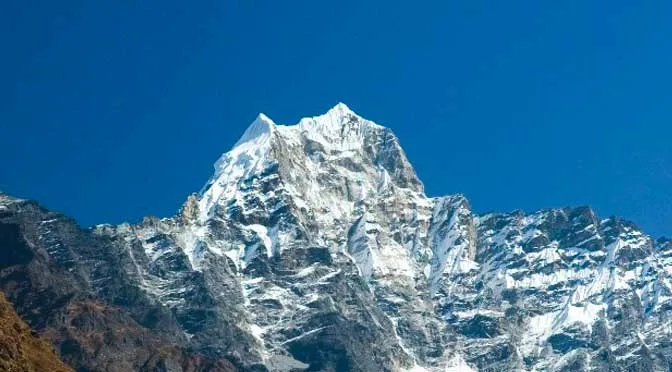
A rest day at Tangnag means a short exploratory hike above camp rather than sitting still. The moraines above the valley offer views of Kusum Kanguru’s south face, which lets you study the route ahead. The peak looks formidable from this angle: a pyramid of rock and ice with no obvious easy line. Spend an hour or two above the settlement, then return to eat, hydrate, and rest. This day matters more than it seems. Climbers who rush acclimatization here often pay for it higher up.
The trail to base camp leaves the valley floor and climbs over moraines and rocky scree, with the glacier visible to your left. Kusum Kanguru grows larger with every step, its ridgelines sharper and more complex up close. The base camp sits on a flat, stony platform at around 5,000 meters, sheltered by a moraine wall on one side and open to the southwest ridge on the other. From camp you can see the full lower face and identify the first technical sections that await above. The rest of the day is for setting up tents, sorting climbing gear, and a briefing with your climbing guide on the route and rescue plan.
A full day at base camp to acclimatize at altitude before the technical climbing begins. The team conducts a short equipment check: crampons fitted to boots, harnesses sized and adjusted, ropes inspected. Afternoon clouds typically roll in from the south, dropping visibility and temperature. You spend the rest of the day resting inside the tent, eating, and mentally preparing. The stars above base camp on a clear night are extraordinary, the Milky Way visible as a pale band arching overhead.
Roped up and wearing crampons for the first time on this trip, you begin climbing toward High Camp. The lower section moves over rocky terrain with sections of fixed rope already in place from the lead guides. Above a short ice wall, the angle eases briefly before steepening again across an exposed snow slope. Camp I sits in a sheltered notch on the southwest ridge, just large enough for two or three tents anchored against the wind. The views from here are already extraordinary: the Hinku Valley far below, and the Khumbu peaks ranked in a line to the north.
You leave Camp I before dawn with headlamps cutting through the dark. The air is thin and cold, breathing deliberate. The upper route involves a steep mixed section of rock and ice followed by a sharp ridge traverse where both hands and feet are in use. Fixed ropes continue through the technical crux. The summit itself is a small rocky platform at 6,367 meters, wide enough for a few people at a time. On a clear day, Everest, Lhotse, Makalu, Cho Oyu, Thamserku, and Kangtega are all visible in a 360-degree panorama that no photograph fully captures. The descent to base camp is careful and methodical. By evening you are back at base camp, the climb behind you.
This day is held deliberately in the schedule as a buffer. Bad weather, technical delays, or a failed summit attempt can push the climb a day. If the summit went well and conditions allow, this becomes a full rest day at base camp to recover before the descent. Sore legs, swollen fingers from the cold, and the particular tiredness that comes after a summit day are normal. Eat well and drink plenty of fluids.
Breaking camp and descending feels faster and lighter than the approach. The moraines that took effort to climb over on the way up pass quickly on the way down. The Hinku Valley is greener and more alive again below the glacier. Tangnag feels almost warm by comparison to the exposed base camp. The stone tea house there serves simple dal bhat and warm drinks. After days of freeze-dried and high-altitude rations, even basic food tastes exceptional.
The descent through the Hinku Valley reverses the approach in a single long day. The trail follows the river closely, passing through sections of forest where sunlight filters through and birdsong returns after days of alpine silence. Khote comes into view in the early afternoon, its small cluster of buildings recognizable from the approach. Your legs are tired but the worst of the technical terrain is behind you.
The return climb over Khari La feels harder on descent-weary legs than it did on the approach. The ridge crossing offers a last look back into the Hinku, already receding into forest and distance. From the pass, the trail drops through familiar rhododendron and pine into the Khumbu, and Namche appears ahead in its horseshoe bowl. After more than a week in the wilderness, the bakeries and wi-fi of Namche feel like genuine luxury. Take the evening to eat well and rest.
The descent from Namche unwinds quickly, the trail now completely familiar under your feet. The suspension bridges, the Bhote Koshi river, the tea houses at Phakding: all pass in a comfortable rhythm. Lukla is reached by late afternoon, the airstrip visible from a distance. The evening is for celebration: the team gathers for a final dinner together, stories from the summit are told, and the peculiar post-expedition emotion sets in. Nepal Holiday Treks arranges a farewell dinner with the team.
The morning flight back to Kathmandu is short, but the view of the peaks on a clear day makes it memorable. Back in Kathmandu, you have the afternoon free before your international departure. Thamel is well-stocked with shops for last-minute souvenirs, Himalayan salt, thangka paintings, and yak wool products. If your flight is the next day, the city offers one more evening to decompress before the journey home.
Includes/Excludes
Cost Includes
- Airport pickup & drop
- Professional climbing guide
- climbing permit
- Trekking permits
- Accommodation during the trek
- Tented camp at Base Camp
- All meals during the trek
- Climbing training
- Safety equipment
- First aid support
- Support staff
Cost Excludes
- International airfare
- Personal climbing gear
- Travel insurance
- Personal expenses
- Tips for guide & porter
- Extra accommodation
- Emergency rescue
FAQs
It is considered one of the hardest trekking peaks in Nepal. The climb involves rock, ice, and mixed terrain, requiring basic mountaineering skills, previous high-altitude experience, and good physical fitness.
Yes. This is not a walk-up peak. Prior experience with crampons, ice axe, and fixed ropes is strongly recommended. Some climbers complete a basic mountaineering course before attempting it.
Spring (March to May) and autumn (October to November) offer the most stable weather windows. Winter and monsoon climbs are possible but carry significantly higher risk.
Yes. A Nepal Mountaineering Association (NMA) permit is required. Your trek operator handles this as part of the package.
Mountaineering boots, crampons, ice axe, harness, helmet, and layers for sub-zero summit temperatures are essential. A full gear checklist is provided upon booking.